Last July, I signed off from the real world for 24-days and participated in a geology field camp of Iceland. The course was led by Dr. Jim Reynolds of Brevard Mountain College in North Carolina. Dr. Reynolds is an authoritative geologist of Iceland and the Galapagos Islands. I had first met Dr. Reynolds on a multi-day Geological Society of America (GSA) field trip in the Scablands of Washington, where my long-term desire to visit Iceland was rekindled.
There were twelve of us, including students from several universities, I was one of the old people at 34. We were outfitted with a large wall tent for studying, socializing, cooking, and dining. My two-person tent and down sleeping bag made the perfect base to attempt sleeping in 24-hour sunlight, synthesize notes, practice Icelandic pronunciations, and sometimes escape what can be expected during field camp evenings. The 24-hour sunlight combined with the fascinating geology made it too easy to forget about sleep. I often ventured up volcanoes, craters, and explored other peculiar volcanic and glacial landforms well into the morning hours.
It is very difficult to summarize this trip, so please bear with my attempt to write towards technical and non-technical audiences ! The trip was intensive and oriented around seeing a lot of Iceland. We wasted no time, immediately upon arrival at the Keflavík airport we started exploring the geothermal area of Seltun and Gunnuheur, where steam vents, boiling and exploding mud pits initiated my excitement for what was to come (Photo 1). At Reykjanesviti, the southwestern rift zone comes ashore and we stood between the North American and Eurasian plates on a micro-plate. We climbed up a graben composed of pyroclastic breccias and pillow basalts and sketched the recent tectonic and volcanic landforms (Photo 2).
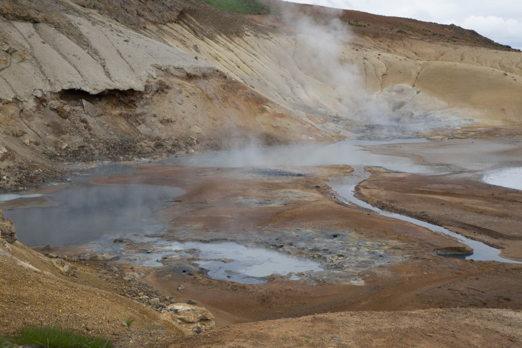
Photo 1: geothermal area in the southwest rift zone
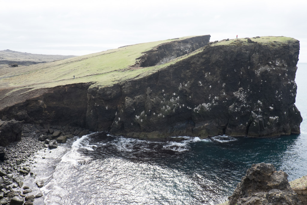
Photo 2: Graben at Reykjanesviti, photo taken between the Eurasian and North American plates. One of the youngest places on earth
The next few days were busy both socially and scientifically, we based at a campground walking distance from downtown Reykjavík and explored the Þingvellir escarpment, Gullfoss waterfall (Photo 3), and the Haukadalur geyser field. By this time, the group personalities were well presented, I had developed a reputation as having a dry Canadian sense of humour, difficult to find, and always the last one back to meeting points. I was having the time of my life exploring the geology of Iceland.
The Snæfellsnes Peninsula was a special place, hiking up and around the Eldborg spatter cone was a highlight, the crater is dated between 5-8 kya, about 60 m high and 150 to 180 m diameter (Photo 4). One evening while camping along the ocean at Arnarstapi, I climbed a mountain called Stapafell (526 m) and observed a 350 m thick sequence of volcano-sedimentary rocks, gaining newfound respect for the complexity of volcanic processes and diversity of associated rock types. That night, I also realized that climbing these mountains can be a bit sketchy, it can be very difficult to find competent rock. Regardless, I made it to the top just after midnight, enjoyed a half hour of breathtaking peace, reflection, and views before my adventure back down, which is another story in itself. I was back in my tent by 2 am, with only minor injuries from aggressive, dive bombing Arctic Terns. The next day, we observed a shield volcano, a tuff cone, and wrapped up our exploration of the peninsula at Bjarnarhöfn farm, with a traditional tasting of putrefied shark.
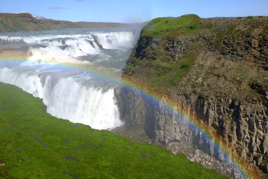
Photo 3. Gullfoss waterfall, canyon carved by paleo-floods plucking through the columnar basalts
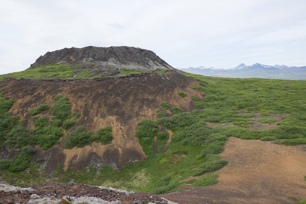
Figure 4. Eldborg spatter cone, 60m high and 180m wide. Last eruption 5 – 8 kya.
Solo Climb of Stapafell, just after midnight
We covered Northeast Iceland in a few days, with visits at Grábrók cinder cone, Hvitserkur dike (Photo 6), the basalt plug of Borgarvirki, and the Akureyri area. I was amazed at the expansiveness of recent glacial landforms and the fjords, some of which extend over 100 km inland. In one glacio-fluvial valley, I counted over one hundred kames, which are mounds of sand and gravel left as the glaciers melted. The Tujas were incredible landforms, distinct flat table top mountains extending high above the valleys. These were formed by volcanic eruptions beneath the glaciers during previous glaciations, as the glaciers retreated and melted, the imposing mountains were left behind. The flat mountain top represents the former top of the glacier. It is humbling to realize how young these landforms are, and how fire and ice can work together to create astonishing mountains.
In the northern part of the country, we setup a nice lakeside base camp at Mývatn for three days. From here we investigated the Skútustaðir rootless craters (Photo 7), Dimmuborgir subsidence feature, Hverfell tuff cone, Dettifoss waterfall, Hrossaborg cinder cone, Námafjall Hverir geothermal area, and the Mývatn Fires and Krafla Fires lava flows (Photo 8), in the northeastern rift zone. I was particularly amazed by the Viti Maar, an 800 m wide, 150-200 m deep crater that resulted from an underground explosion of superheated groundwater, this crater was created in 1875! (Photo 9). Another highlight was observing a cross section of a feeder dike at the Hafragilsfoss waterfall, here the dike is exposed on river right extending upwards below the cinder cone chain thanks to scouring from jökulhlaups (catastrophic glacial outburst floods), see Photo 11. This is one of the many dikes associated with the Randhólar cinder cone chain, the longest in Iceland (~70km). A dike is a crack or fissure filled with volcanic rock, where the lava rose up to erupt at the surface.
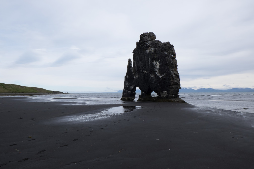
Photo 6. Hvitserkur dike, left standing. This was once a fissure in the ground that had filled in from below as lava made its way upwards to erupt.
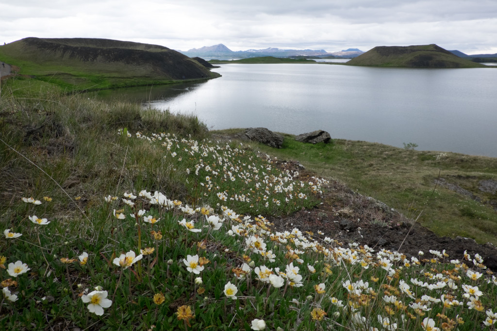
Photo 7. Rootless craters at Skútustaðir
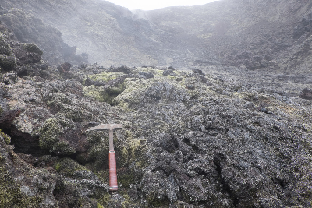
Photo 8. The Krafla eruption, still cooling off 30 years later
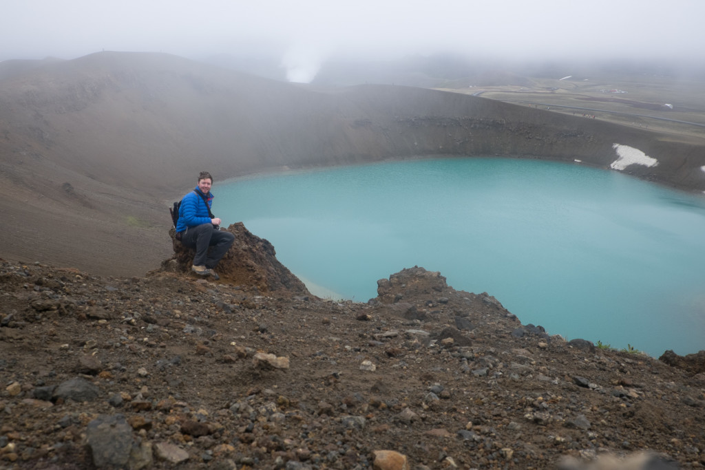
Photo 9. The Viti Maar, crater from an explosion of superheated groundwater in 1875.
Continuing north, we investigated unbelievable jökulhlaup landforms at Ásbyrgi and Hljóðaklettar. In the Ásbyrgi area, the tremendous power of the paleo-floods was humbling, the flows scoured huge canyons, ripped apart the core of a volcano (Photo 10), left coulees, a 100 m high dry waterfall, and huge sub-rounded eratics remain atop a scoured basalt plain. Up to 900,000 m3/second of water came ripping through this area during its largest floods, this is not much less than the cumulative flow of all of the world’s rivers today. At the northernmost point of mainland Iceland at Hraunhafnartangi on the Melrakkasletta peninsula, we debated a skinny dip in the Arctic Ocean, but the water was rough, it was bitter cold and beginning to snow, there always seems to be excuses.
The drive from Vopnafjörður to Egilsstaðir was a glacial geology paradise. Lateral, medial, terminal moraines, kames, eskers, epic glacio-fluvial terraces, are just some of what can be observed along this route. The continental scale of these landforms offered my imagination a glimpse of what some areas of the US Midwest may have looked like immediately following the retreat of the Wisconsin glaciation, before soils and vegetation were established.
We explored the East Iceland fjords, observing some of the older rock of Iceland (Miocene age). Dikes were exposed everywhere, cutting and criss-crossing through the inland dipping mountain sides that consisted of basalt flows, intercalations, and tuffaceous rock. We discovered zeolite zones, explored rhyolitic intrusions, and also tracked down some obsidian. The group was growing more tired, and the expected range of group dynamics was evolving, my late arrivals to meeting points were becoming less tolerated. After exploring East Iceland, the trip across South Iceland was highlighted by investigating the glaciers at Hoffelsjökull, Jökulsárlón, Skaftefellsjökull, and Sólheimajökull (Figure 12). We spent a day observing the landforms and geology of the 1783-84 Laki fissure eruption, and ended the day logging exposed formations at the Fjaðárglúfur canyon.
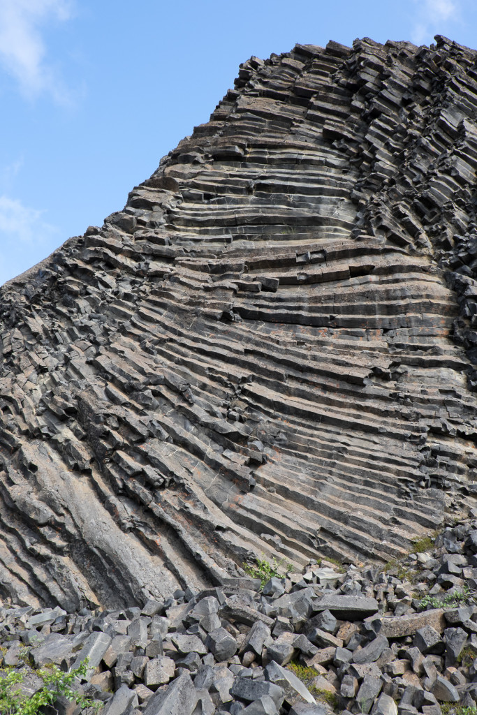
Photo 10. The more resistant horizontally jointed basalt core of a volcanic feeder system left in place, jökulhlaups have scoured all the rock that once concealed it beneath the surface
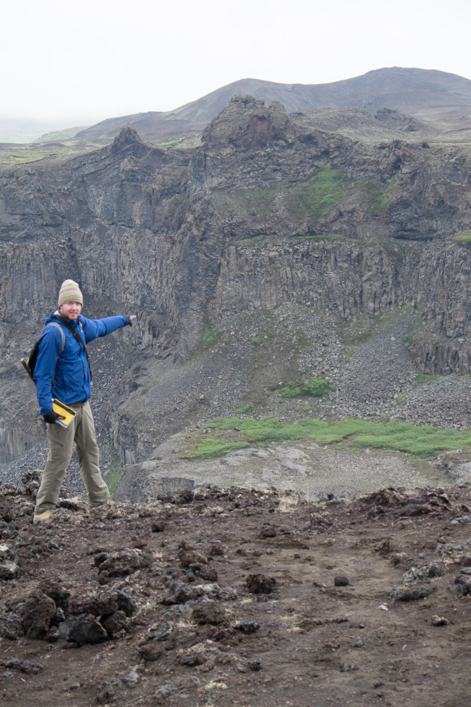
Photo 11. The feeder dike exposed underneath the Hrossaborg cinder cone. Cross section view thanks to jökulhlaup scoured canyon
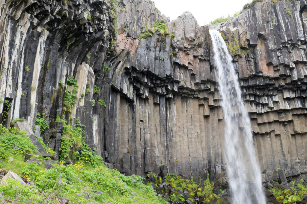
Photo 12. Svartifoss waterfall exposing beautiful columnar jointed basalts
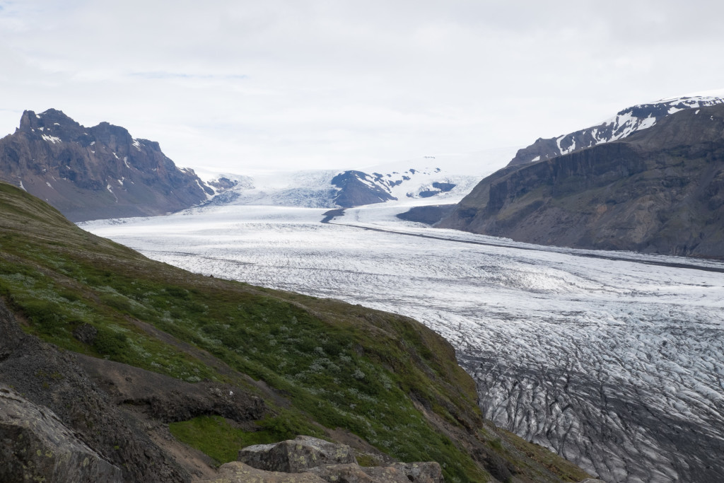
Photo 13. Skaftafellsjökul Glacier with bands of ash, and medial moraine visible
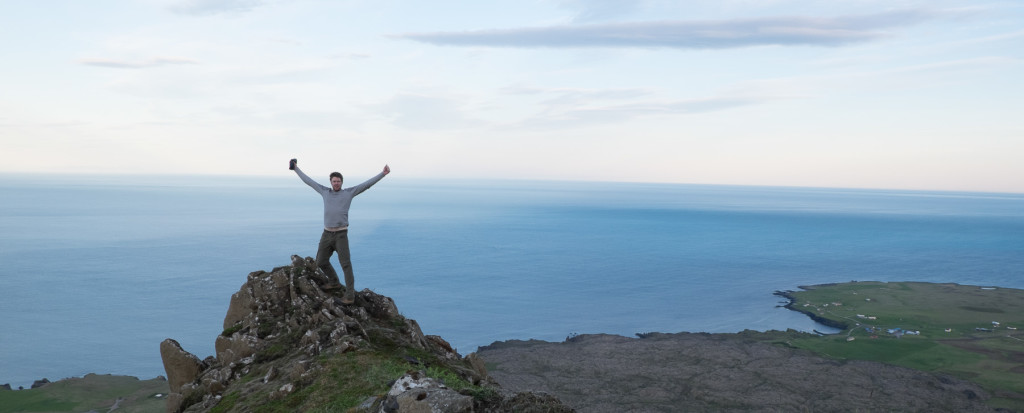
Before returning to Reykjavík, a day and night was spent on the island of Heimaey, we explored the island and climbed the still steaming Eldfell volcano that erupted in the town of Vestmannaeyjar in 1973. That last field night was a memorable one, a few of us climbed a crater, offering tremendous views, an “almost” sunset, and hundreds of curious Arctic Puffins literally whizzing by our heads. It was an amazing way to close out a trip I will never forget!
The geology camp allowed me to better understand terrestrial, submarine, and subglacial igneous and volcano-sedimentary processes and rock types. I am exited about applying this in my work throughout the Caribbean, Central America, and South America. Iceland also perfectly suited my Quaternary geology background from British Columbia and fed my childhood fascination with catastrophic outburst floods. I also must highlight the importance of being with an expert that knows the country on such a trip. Even as an experienced geologist, I would have missed so much if Dr. Reynolds was not there to point things out or encourage us to “look closer”. The trip was most special because I was able to sign off and be nothing other than a field geologist, learning and living in Iceland. It took a few days for my brain to settle from my high paced life of running an organization, but once I was there, it was a euphoric place both mentally and physically. I also ended up with an A in the course and a few new friends! My girlfriend and I have since named our new puppy “Tuya” after the volcanic mountains in Iceland and British Columbia.
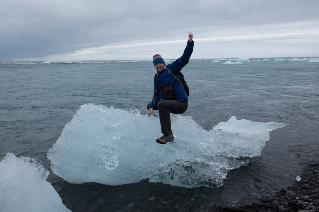
My very first “Whale Berg”, whale berg opportunities are becoming rarer due to climate change impacts